3-D Globe Displays
Use globe display functions to visualize 3-D data over terrain, high-zoom-level basemaps, and other surfaces. Navigate globe displays interactively, or change your view programmatically by setting the camera position and camera rotation angles.
Display data such as flight trajectories over terrain, buildings, and basemaps by using a geographic globe. You can plot height data with respect to the geoid, terrain, or WGS84 reference ellipsoid. For more information, see
geoglobe.Display data such as sea surface temperature and wind speed as a surface by using a globe projection. You can also use globe projections to model various reference ellipsoids, including ellipsoids for non-Earth planetary bodies. For more information, see
globe.
Functions
Topics
- Access Basemaps and Terrain for Geographic Globe
The geographic globe plots data over basemaps and terrain. Download some of these basemaps or add custom basemaps and terrain.
- Use Basemaps in Offline Environments
Display data over basemaps when MATLAB® has temporary or no internet access.
- Create Interactive Basemap Picker
Interactively change the basemap of a geographic globe by using a drop-down menu.
- Find Ellipsoidal Height from Orthometric Height
Find the ellipsoidal height of a point by using its orthometric height and a geoid model.
Related Information
Featured Examples

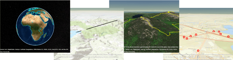
Visualize Aircraft Line-of-Sight over Terrain
Compute and visualize line-of-sight visibility of an aircraft from a ground location over terrain.

Visualize UAV Flight Path on 2-D and 3-D Maps
Simulate an unmanned aerial vehicle (UAV) flight using synchronized geographic axes and a geographic globe.

Radar Vertical Coverage over Terrain
Define an L-band radar system in the presence of heavy clutter and visualize its three-dimensional vertical coverage over terrain.