removeCustomTerrain
Remove custom terrain data
Description
removeCustomTerrain( removes
the custom terrain data specified by the user-defined
terrainName)terrainName. You can use this function to remove terrain data
that is no longer needed. The terrain data to be removed must have been previously
added using
addCustomTerrain.
Examples
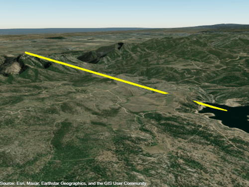
Display a line from the surface of Gross Reservoir to a point above South Boulder Peak using custom terrain.
First, add terrain for an area around South Boulder Peak by calling addCustomTerrain and specifying a DTED file. The DTED file is from the SRTM Void Filled data set, available from the US Geological Survey. Name the terrain "southboulderpeak".
addCustomTerrain("southboulderpeak","n39_w106_3arc_v2.dt1")
Create a geographic globe. Specify the terrain by name, using the "Terrain" argument of the geoglobe function. Then, plot the line. Tilt the view by holding Ctrl and dragging.
uif = uifigure;
g = geoglobe(uif,"Terrain","southboulderpeak");

lat = [39.95384 39.95];
lon = [-105.29916 -105.3608];
hTerrain = [10 0];
geoplot3(g,lat,lon,hTerrain,"y","HeightReference","Terrain","LineWidth",3)
Close the geographic globe and remove the custom terrain.
close(uif)
removeCustomTerrain("southboulderpeak")
Input Arguments
Version History
Introduced in R2020a