Main Content

Lidar Processing

Velodyne® file import, segmentation, downsampling, transformations, visualization, 3-D point cloud registration, and lane detection in lidar data

Advanced driver assistance systems use 3-D point clouds obtained from lidar scans to measure physical surfaces. Lidar point cloud processing enables you to downsample, denoise, and transform these point clouds before registering them or segmenting them into clusters. You can also read, write, store, display, and compare point clouds, including point clouds imported from Velodyne packet capture (PCAP) files.

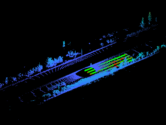
You can also detect road lanes in lidar point clouds using a deep learning approach. Automated Driving Toolbox™ provides a lidar lane detection network trained on the K-Lane data set. The pretrained network enables you to detect a maximum of six lanes. You can also evaluate the performance of detector using different metrics, such as classification accuracy, precision, recall, and F1-score.

To detect lanes in lidar point clouds, download the Automated Driving Toolbox Model for Lidar Lane Detection support package from the Add-On Explorer. For more information on downloading add-ons, see Get and Manage Add-Ons.

Functions

expand all

pointCloudObject for storing 3-D point cloud
velodyneFileReaderRead point cloud data from Velodyne PCAP file
pcreadRead 3-D point cloud from PLY or PCD file
pcwriteWrite 3-D point cloud to PLY or PCD file
ibeoFileReaderRead message headers from Ibeo Data Container (IDC) file (Since R2021a)
selectSelect subset of messages to read from Ibeo Data Container (IDC) file (Since R2021a)
ibeoMessageReaderObject for reading message content from Ibeo Data Container (IDC) file (Since R2021a)
readMessagesRead messages from Ibeo Data Container (IDC) file selection (Since R2021a)
pcdenoiseRemove noise from 3-D point cloud
pcdownsampleDownsample a 3-D point cloud
pcmergeMerge two 3-D point clouds
pcnormalsEstimate normals for point cloud
pctransformTransform 3-D point cloud
pcplayerVisualize streaming 3-D point cloud data
pcshowPlot 3-D point cloud
pcshowpairVisualize difference between two point clouds
pcregistercpdRegister two point clouds using CPD algorithm
pcregistericpRegister two point clouds using ICP algorithm
pcregisterndtRegister two point clouds using NDT algorithm
pcregisterloamRegister two point clouds using LOAM algorithm (Since R2022a)
pcsegdistSegment point cloud into clusters based on Euclidean distance
segmentLidarDataSegment organized 3-D range data into clusters
segmentGroundFromLidarDataSegment ground points from organized lidar data
pcfitplaneFit plane to 3-D point cloud
planeModelObject for storing parametric plane model
lidarLaneDetectorCreate lane detector for lidar data (Since R2023b)
trainLidarLaneDetectorTrain lane detector for lidar data (Since R2023b)

Topics

Featured Examples