TIREM
TIREM propagation model
Description
Model the behavior of electromagnetic radiation from a point of transmission as it
travels over irregular terrain, including buildings, by using the Terrain Integrated Rough Earth Model™ (TIREM™) model. Represent the TIREM model by using a TIREM object.
The TIREM model:
Is valid from 1 MHz to 1000 GHz.
Calculates path loss from free-space loss, terrain and obstacle diffraction, ground reflection, atmospheric refraction, and tropospheric scatter.
Provides path loss estimates by combining physics with empirical data statistics.
To predict path loss in scenes that feature buildings, such as urban environments,
consider using a ray tracing propagation model. For more information about ray tracing models,
see RayTracing.
TIREM objects require access to an external TIREM library. For more information, see Access TIREM Software.
Creation
Create a TIREM object by using the propagationModel
function.
Properties
Examples
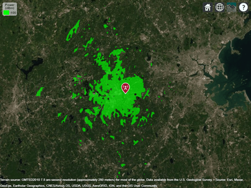
Display the coverage area for a transmitter using the TIREM model.
pm = propagationModel("tirem");
tx = txsite("Name","Apple Hill","Latitude",42.3001,"Longitude",-71.3604);
coverage(tx,pm)
More About
Tips
By default, functions that accept a TIREM object as input use
terrain elevation data hosted by MathWorks® and derived from the GMTED2010
model by the USGS and NGA. To use terrain elevation data from DTED files instead, first add
the terrain by using the addCustomTerrain function.
Then, use the terrain by specifying the Terrain property of a siteviewer object or by
specifying the Map argument of a propagation function such as sigstrength or sinr.
References
[1] Seybold, John S. Introduction to RF Propagation. Hoboken, N.J: Wiley, 2005.
Version History
Introduced in R2017b