mapresize
Resize planar map raster
Syntax
Description
Examples
Import a sample planar map raster and map cells reference object. Query the size of the raster.
[Z1,R1] = readgeoraster("map_sample.tif");
R1.RasterSize
ans = 1×2
2 2
Resize the raster. Double the length and width of the raster by specifying the scale as 2. Use nearest neighbor interpolation by specifying the interpolation method.
[Z2,R2] = mapresize(Z1,R1,2,"nearest");
R2.RasterSize
ans = 1×2
4 4
Read an image of Boston into the workspace as an array and a map cells reference object. Display the image on a map.
[A,R] = readgeoraster("boston.tif");

figure
mapshow(A,R)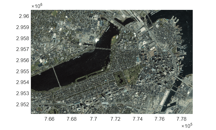
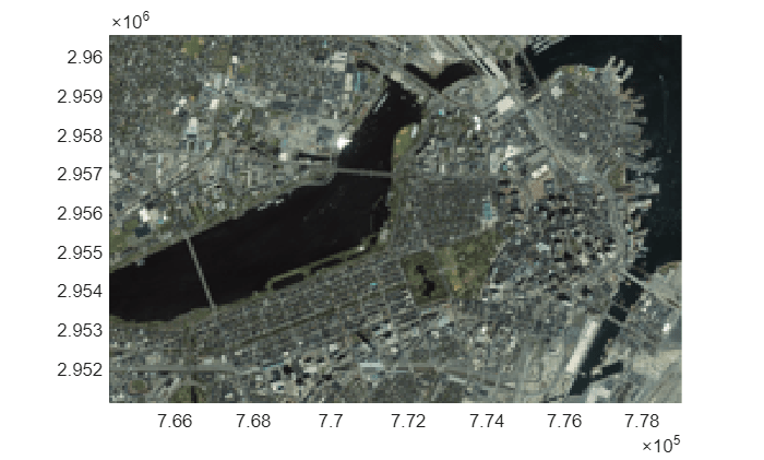
Resize the data using a scale of 0.05. The height and width of the resized image are each one-twentieth of the original height and width.
[B,RB] = mapresize(A,R,0.05);
Display the resized raster on a new map. Note that the cells in the resized map appear larger than the cells in the original map.
figure
mapshow(B,RB)
Input Arguments
Output Arguments
Tips
To resize a raster in geographic coordinates, use the
georesizefunction.Resample a raster by using the
mapresamplefunction. Raster resampling is useful for matching the resolutions of related rasters.
Version History
Introduced in R2019a