satelliteScenarioViewer
Description
The satelliteScenarioViewer object represents a 3D visualization
of the satelliteScenario object. Use this object to focus the camera onto the
satellite or the ground station by double-clicking the satellite or ground station. Once
focused, you can rotate the camera and it will orbit around the selected satellite/ground
station and not be allowed to pan out. To unfocus, you must double-click elsewhere in the
viewer or press the home button.
Creation
Syntax
Description
satelliteScenarioViewer( creates a
3-D or 2-D satellite scenario viewer for the specified satellite scenario. Satellite
Scenario Viewer is a 3-D map display and requires hardware graphics support for
WebGL™.scenario)
v = satelliteScenarioViewer(scenario)
satelliteScenarioViewer(
sets properties using one or more
optional name-value arguments. For example,
scenario,Name=Value)satelliteScenarioViewer(scenario,Position = [1 1 500 500]) sets the
position to [1 1 500 500].
Properties
Name — Name of viewer window
'Satellite Scenario Viewer' (default) | string scalar | character vector
Name of the viewer window, specified as a comma-separated pair consisting of
'Name' and either a string scalar or a character vector.
Data Types: char | string
Position — Viewer window position
center of the screen (default) | row vector of four elements
Size and location of the satellite scenario window in pixels, specified as a row
vector of four elements. The elements of the vector are [left bottom width
height]. In the default case, width and height are 800 and 600 pixels,
respectively.
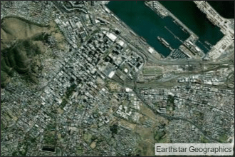
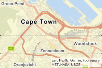
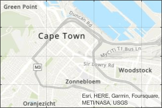
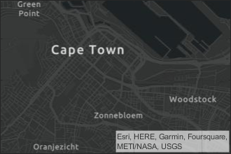
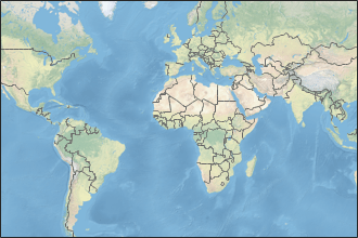
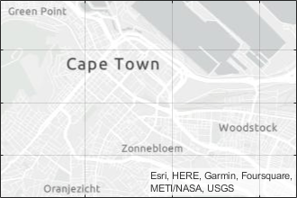
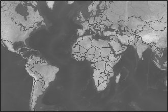
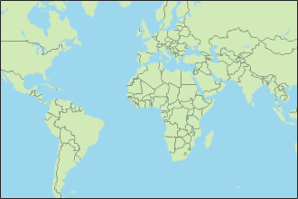
Basemap — Map on which scenario is visualized
'satellite' (default) | 'topographic' | 'streets' | 'streets-light' | 'streets-dark' | 'darkwater' | 'grayland' | 'bluegreen' | 'colorterrain' | 'grayterrain' | 'landcover'
Map on which scenario is visualized, specified as a comma-separated pair consisting
of 'Basemap' and one of the values specified in this
table:
|
|
Full global basemap composed of high-resolution satellite imagery. Hosted by Esri®. |
|
General-purpose road map that emphasizes accurate, legible styling of roads and transit networks. Hosted by Esri. |
|
|
General-purpose map with styling to depict topographic features. Hosted by Esri. |
|
Map designed to provide geographic context while highlighting user data on a dark background. Hosted by Esri. |
|
|
Map that combines satellite-derived land cover data, shaded relief, and ocean-bottom relief. The light, natural palette is suitable for thematic and reference maps. Created using Natural Earth. |
|
Map designed to provide geographic context while highlighting user data on a light background. Hosted by Esri. |
|
|
Shaded relief map blended with a land cover palette. Humid lowlands are green and arid lowlands are brown. Created using Natural Earth. |
|
Terrain map in shades of gray. Shaded relief emphasizes both high mountains and micro-terrain found in lowlands. Created using Natural Earth. |
|
|
Two-tone, land-ocean map with light green land areas and light blue water areas. Created using Natural Earth. |
|
Two-tone, land-ocean map with gray land areas and white water areas. Created using Natural Earth. |
|
|
Two-tone, land-ocean map with light gray land areas and dark gray water areas. This basemap is installed with MATLAB®. Created using Natural Earth. |

All basemaps except 'darkwater' require
Internet access. The 'darkwater' basemap is included with MATLAB and Aerospace Toolbox.
If you do not have consistent access to the Internet, you can download the basemaps created using Natural Earth onto your local system by using the Add-On Explorer. The basemaps hosted by Esri are not available for download.
Alignment of boundaries and region labels are a presentation of the feature provided by the data vendors and do not imply endorsement by The MathWorks®.
Data Types: char | string
PlaybackSpeedMultiplier — Speed of animation
50 (default) | positive scalar
Speed of the animation for the input scenario used by the
play function,
specified as a comma-separated pair consisting of
'PlaybackSpeedMultiplier' and a positive scalar.
CameraReferenceFrame — Reference frame of camera
'ECEF' (default) | 'Inertial'
Reference frame of the camera, specified as a comma-separated pair consisting of
'CameraReferenceFrame' and one of these values:
'ECEF'— Earth-Centered Earth-Fixed camera.'Inertial'— Inertially fixed camera.
When you specify 'Inertial', the globe rotates with respect to
the camera. When you specify 'ECEF', the camera rotates with the
globe.
Dependencies
To enable this name-value argument, set to Dimension to
'3-D'.
CurrentTime — Current simulation time
StartTime of
satelliteScenario (default) | datetime array
Current simulation time of the viewer, specified as a datetime array. This value changes over time when the animation is
playing.
Dependencies
To enable this name-value argument, set AutoSimulate to true.
Data Types: datetime
Dimension — Dimension of viewer
'3D' (default) | '2D'
Dimension of the viewer, specified as a comma-separated pair consisting of
'Dimension' and either '3D' or
'2D'.
ShowDetails — Flag to show graphical details
true or 1 (default) | false or 0
Flag to show the graphical details for Satellite Scenario Viewer, specified as one of these numeric or logical values1.
1(true) — Show all graphical details of satellites and ground stations except those explicitly hidden.0(false) — Hide all graphical details of satellites and the ground stations, including orbits, fields of view, labels, and the ground track. Even whenShowDetailsisfalse, clicking or pausing on satellites and ground stations reveals hidden graphical details or labels, respectively.
Data Types: logical
Object Functions
campos | Set or get position of camera for Satellite Scenario Viewer |
camheight | Set or get height of camera for Satellite Scenario Viewer |
camheading | Set or get heading angle of camera for Satellite Scenario Viewer |
camroll | Set or get roll angle of camera for Satellite Scenario Viewer |
campitch | Set or get pitch angle of camera for Satellite Scenario Viewer |
camtarget | Set camera target for Satellite Scenario Viewer |
play | Play satellite scenario simulation results on viewer |
showAll | Show all graphics in viewer |
hideAll | Hide all graphics in satellite scenario viewer |
Examples
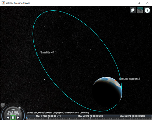
Create and Visualize Satellite Scenario
Create a satellite scenario object.
sc = satelliteScenario;
Add a satellite and ground station to the scenario. Additionally, add an access between the satellite and the ground station.
sat = satellite(sc,"eccentricOrbitSatellite.tle");
gs = groundStation(sc);
access(sat,gs);
Visualize the scenario at the start time defined in the TLE file by using the Satellite Scenario Viewer.
satelliteScenarioViewer(sc);
Version History
Introduced in R2021a
You can also select a web site from the following list:
Americas
- América Latina (Español)
- Canada (English)
- United States (English)
Europe
- Belgium (English)
- Denmark (English)
- Deutschland (Deutsch)
- España (Español)
- Finland (English)
- France (Français)
- Ireland (English)
- Italia (Italiano)
- Luxembourg (English)
- Netherlands (English)
- Norway (English)
- Österreich (Deutsch)
- Portugal (English)
- Sweden (English)
- Switzerland
- United Kingdom (English)