murdoch1
Murdoch I Conic Projection
Classification
Conic
Identifier
murdoch1
Graticule
Meridians: Equally spaced straight lines converging at one of the poles.
Parallels: Equally spaced concentric circular arcs.
Poles: Arcs, one of which might become a point in the limit.
Symmetry: About any meridian.
Features
This is an equidistant projection that is nearly minimum-error. Scale is true along any meridian and is constant along any parallel. Scale is also true along two standard parallels. These must be calculated, however (see remark on parallels below). The total area of the mapped area is correct, but it is not equal-area everywhere.
Parallels
The parallels for this projection are not standard parallels, but rather limiting parallels. The special feature of this map, correct total area, holds between these parallels. The default parallels are [15 75].
Remarks
Described by Patrick Murdoch in 1758.
This implementation of the Murdoch I conic projection is applicable only for coordinates that are referenced to a sphere.
Limitations
Longitude data greater than 135º east or west of the central meridian is trimmed.
Example
landareas = shaperead('landareas.shp','UseGeoCoords',true);
axesm ('murdoch1', 'Frame', 'on', 'Grid', 'on');
geoshow(landareas,'FaceColor',[1 1 .5],'EdgeColor',[.6 .6 .6]);
tissot;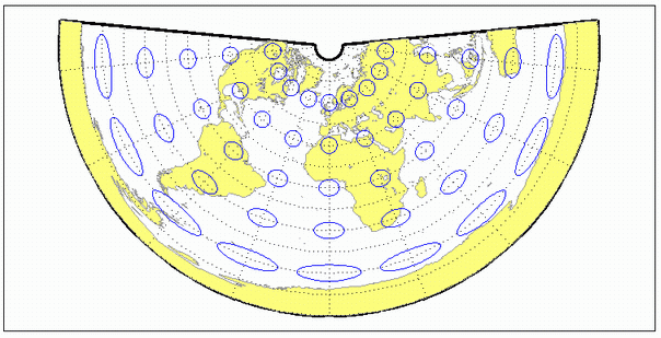
Version History
Introduced before R2006a